Airspace
FAA Airspace Classes Explained for Drone Pilots
Controlled airspace is not closed airspace. Learn to identify the class at your exact launch point, then decide what it obliges you to do.
Key takeaway
Identify the airspace class at the exact coordinates you intend to launch from, not the nearest airport. Class B, C, D and surface Class E all require authorization; Class G does not.
Controlled airspace is not closed airspace. Class B, C, D and surface Class E are all places a Part 107 pilot may legally fly — they simply require prior authorization first. Class G requires none. The entire practical question is: which class is directly above the point I am standing on?
Not the nearest airport. The exact coordinates of your launch site.
| Class | Where it is | Part 107 authorization? |
|---|---|---|
| A | 18,000 ft MSL and above | Irrelevant — you cannot legally reach it |
| B | Busiest airports, tiered shelves | Yes |
| C | Medium airports with radar service | Yes |
| D | Smaller airports with an operating tower | Yes |
| E | Controlled airspace that is not A, B, C or D | Only where it reaches the surface |
| G | Everything else — uncontrolled | No |
Class A: the one you can ignore
Class A begins at 18,000 feet MSL. Everything in it is IFR, and a Part 107 aircraft is limited to 400 feet AGL. It exists on the exam as a definition and nothing more.
Class B: the upside-down wedding cake
Class B surrounds the busiest airports in the country. It is drawn as a series of concentric shelves, each with its own floor, so the airspace steps upward and outward from the center — the shape usually described as an inverted wedding cake.
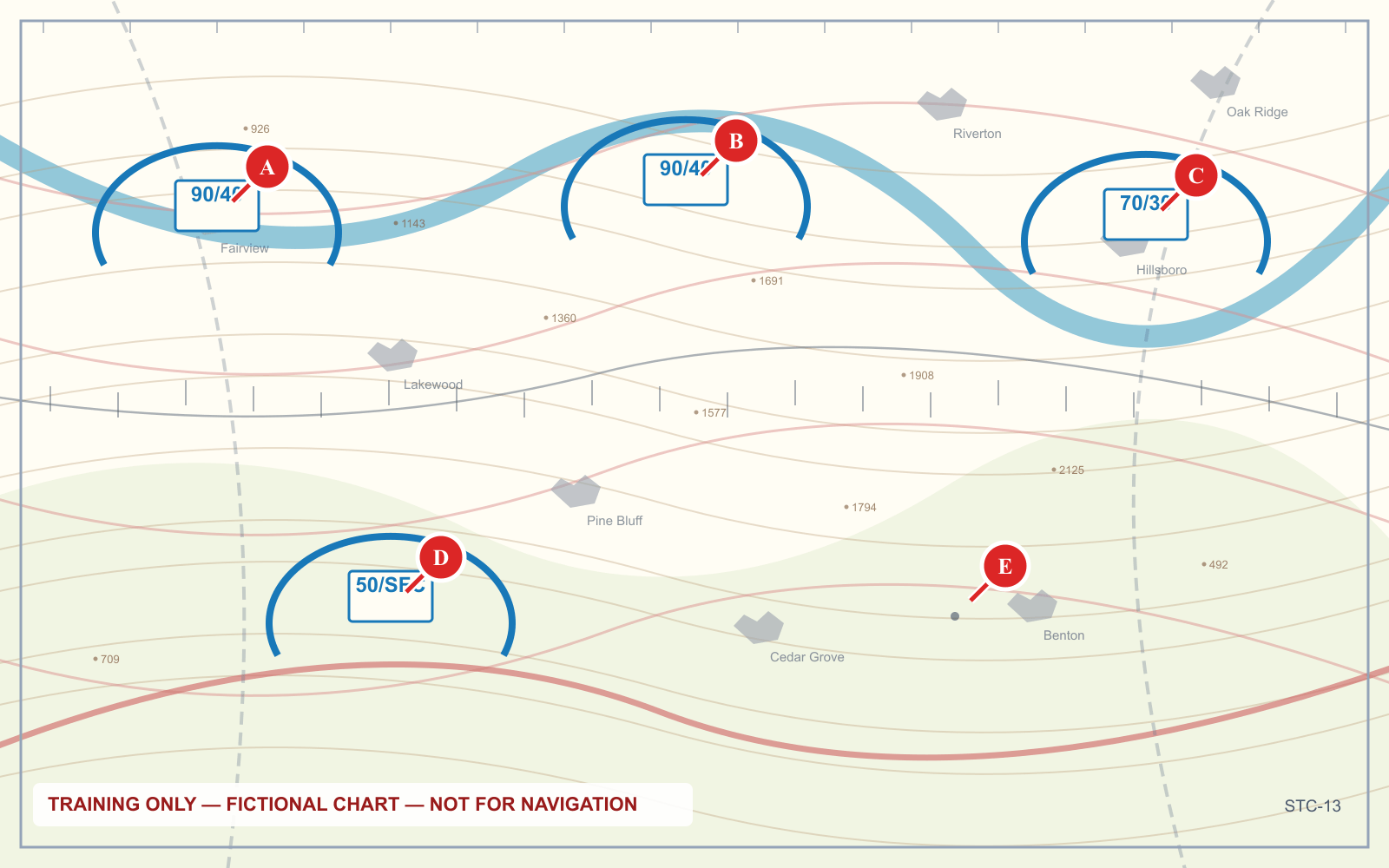
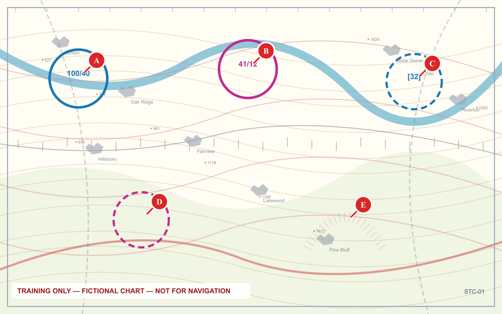
On the chart: solid blue lines.
The critical detail: being inside the outermost blue ring on the chart does not mean you are inside Class B. If the shelf above you has a floor of 4,000 feet MSL, the airspace between the ground and 4,000 is something else — usually Class G, sometimes Class E. A drone at 300 feet under a Class B shelf is frequently in uncontrolled airspace and needs no authorization at all.
Read the boxed numbers to find out. They are ceiling over floor, in hundreds of feet MSL:
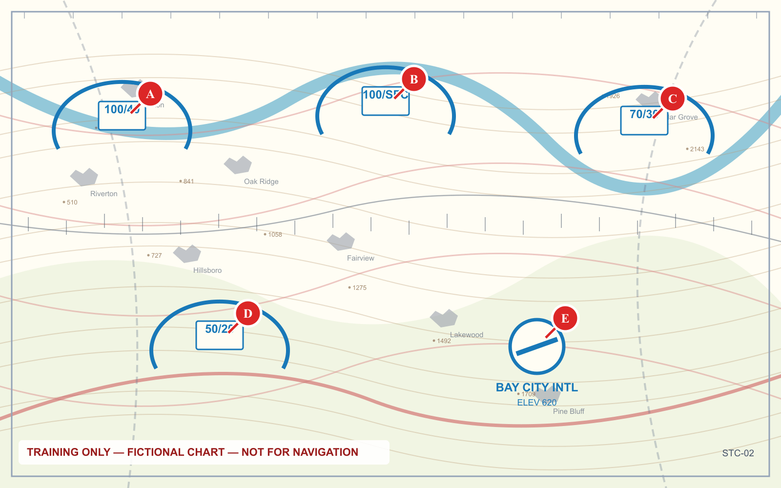
Class C: two rings
Class C surrounds airports with a control tower, radar approach control, and a certain volume of traffic. It is typically drawn as an inner core reaching the surface out to about 5 nautical miles, and an outer shelf from roughly 5 to 10 nautical miles with a floor around 1,200 feet AGL.
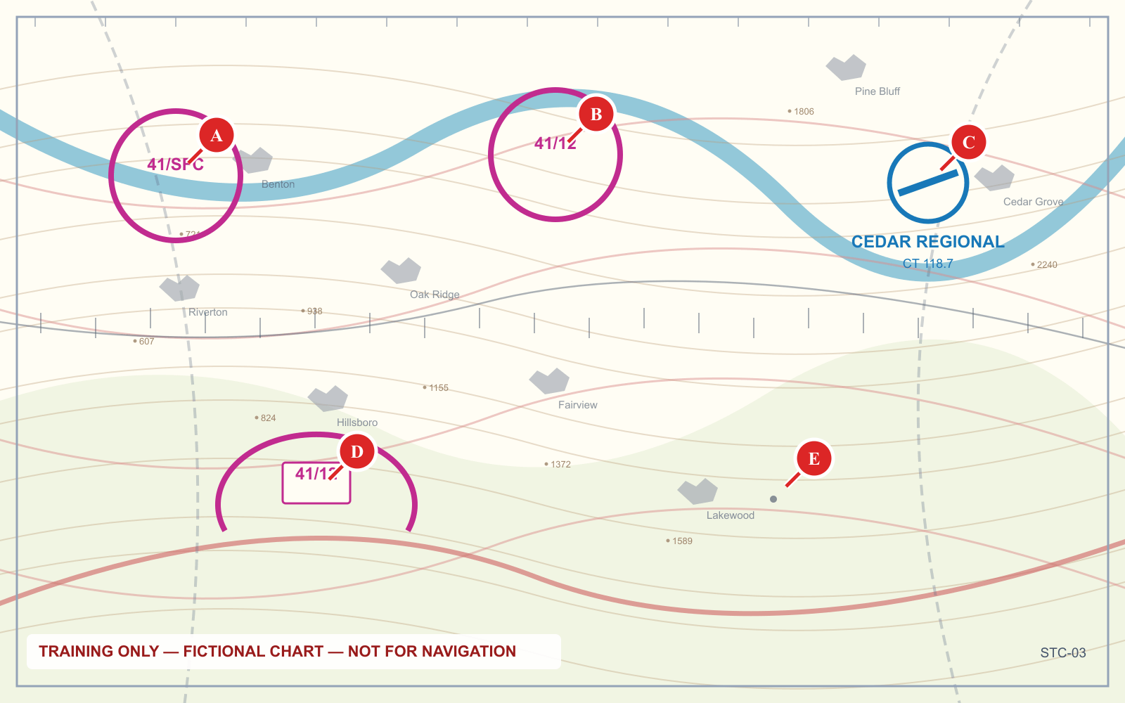
On the chart: solid magenta lines.
Same logic as Class B — under the outer shelf, at drone altitude, you are usually below the airspace rather than in it.
Class D: office hours
Class D surrounds smaller airports with an operating control tower. It is typically a single cylinder about 4 nautical miles in radius, extending from the surface up to roughly 2,500 feet AGL.
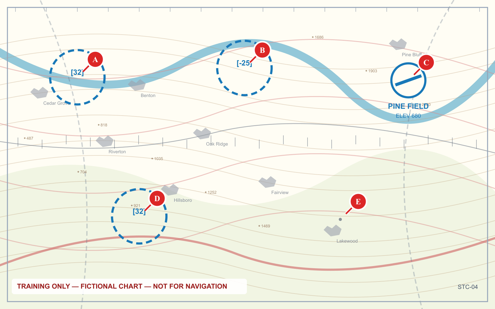
On the chart: dashed blue lines, with the ceiling in a bracketed box.
The detail that catches people: Class D exists only while the tower is operating. When the tower closes, the airspace reverts — usually to Class E, sometimes to Class G. The Chart Supplement tells you the hours. This matters because a field that needs authorization at 2 p.m. may not at 11 p.m., and vice versa.
Class E: the awkward one
Class E is controlled airspace that is not A, B, C or D, and it starts at different heights in different places. That variability is what makes it the hardest class to answer questions about.
The three cases you will meet:
Class E starting at the surface. Drawn as a dashed magenta line. This is a surface area, usually around an airport with instrument approaches but no tower. Authorization is required.
Class E starting at 700 feet AGL. Drawn as a faded magenta vignette — a soft band that fades outward. Inside the shaded edge, Class E begins at 700 feet AGL and Class G lies beneath it. At 400 feet you are in Class G and need no authorization.
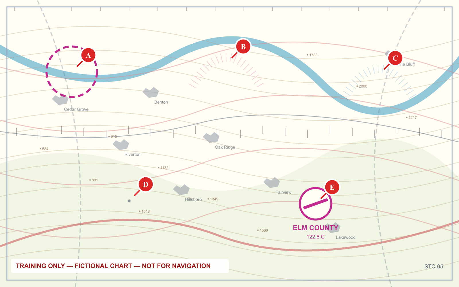
Class E starting at 1,200 feet AGL. The default across most of the country, with no charting at all. Below it is Class G.
The five boundary conventions together, which is really all you need to classify a point:
Class G: where you actually fly
Class G is uncontrolled airspace, and it is where the large majority of Part 107 operations happen. No ATC authorization is required to enter it.
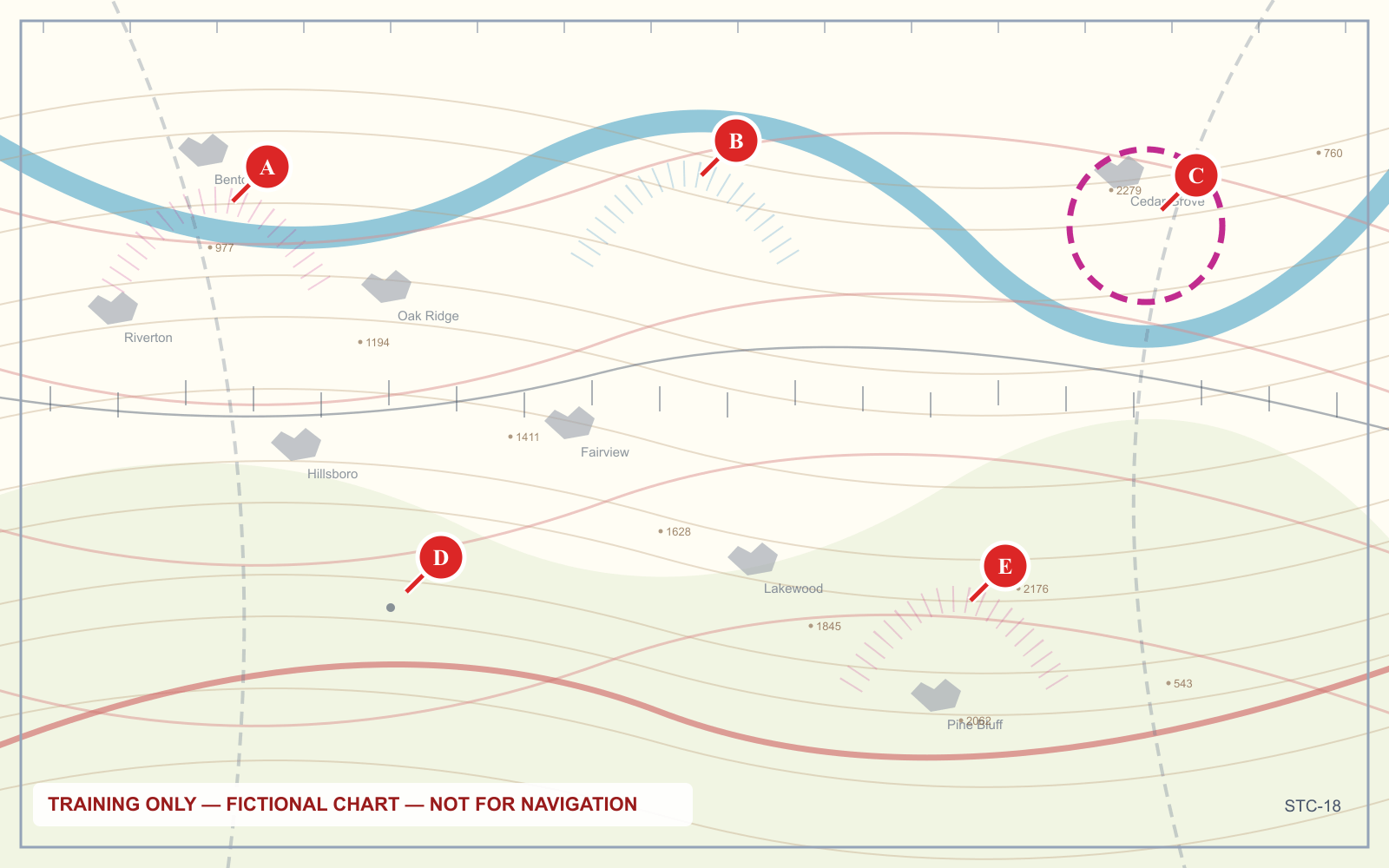
Uncontrolled does not mean unregulated. Every other Part 107 requirement still applies in Class G: 400 feet, visual line of sight, 3 statute miles visibility, 500 feet below and 2,000 feet horizontally from clouds, yielding right of way, and everything else. The only thing Class G removes is the need to ask permission to be there.
It also does not mean empty. Manned aircraft operate in Class G constantly, particularly near non-towered airports, and 14 CFR 107.37 requires you to yield to all of them.
The two-question test
For any launch site, the whole analysis reduces to two questions:
1. What class is directly above this point, at the altitude I intend to fly?
Find the exact point, read the boundary convention around it, and read any boxed floor figures. Remember that being inside a ring on the chart is not the same as being inside the airspace.
2. If it is controlled, do I have authorization?
If the answer to the first question is B, C, D or surface E, you need authorization before you fly. Most of the time that means LAANC, which is near-instant through an approved app for facilities that participate. Where LAANC is unavailable, the route is a manual request through FAADroneZone, which takes considerably longer.
An airspace authorization is not a waiver. It permits you to be in that airspace. It does not relieve you of any other rule, including the weather minimums.
Frequently asked questions
What are the classes of airspace?
Class A begins at 18,000 feet MSL and is IFR only. Class B surrounds the busiest airports in tiered shelves, Class C medium airports with radar service, and Class D smaller airports with an operating tower. Class E is controlled airspace that is not A, B, C or D, and Class G is uncontrolled airspace.
Do I need authorization to fly a drone in controlled airspace?
Yes. Class B, C, D and any Class E that reaches the surface all require prior FAA authorization before a Part 107 operation. Class G requires none. Authorization is usually obtained through LAANC.
How do you tell airspace classes apart on a sectional chart?
Solid blue marks Class B, solid magenta Class C, dashed blue Class D, and dashed magenta a Class E surface area. A faded magenta vignette means Class E begins at 700 feet AGL, with Class G below it.
Am I in Class B if I am under a Class B shelf?
Usually not. Each Class B shelf has its own floor, printed as the lower figure in a boxed pair in hundreds of feet MSL. If the shelf above you has a floor of 4,000 feet MSL, a drone at 300 feet is beneath the Class B, typically in Class G, and needs no authorization for that airspace.
What is Class G airspace?
Class G is uncontrolled airspace requiring no ATC authorization to enter. It is where most Part 107 operations take place, typically below a Class E floor at 700 or 1,200 feet AGL. Every other Part 107 rule still applies there.
Does Class D airspace exist when the tower is closed?
Generally no. Class D depends on the control tower operating. When the tower closes, the airspace normally reverts to Class E or Class G, and the Chart Supplement lists the hours.
Classifying a point is a skill, and the only way to build it is on real chart panels. The sectional chart trainer presents them with lettered points and asks the questions the exam asks.
Sources
Put this guide into practice.
Take the free assessment to see how this topic fits into your current exam readiness.
Start free practice