Airspace
How to Read a Sectional Chart: The Symbols That Matter
A sectional is not a picture of the ground. It is the ground with the rules printed on top, in a color code you can learn in an afternoon.
Key takeaway
Blue means an airport with an operating control tower, magenta means without. Solid boundaries mean the airspace reaches the surface nearby, dashed means it starts at the surface at that line.
A sectional chart is not a picture of the ground. It is the ground with the rules printed on top of it, in a color code you can learn in an afternoon. The greys and greens are scenery. The blue and magenta are law.
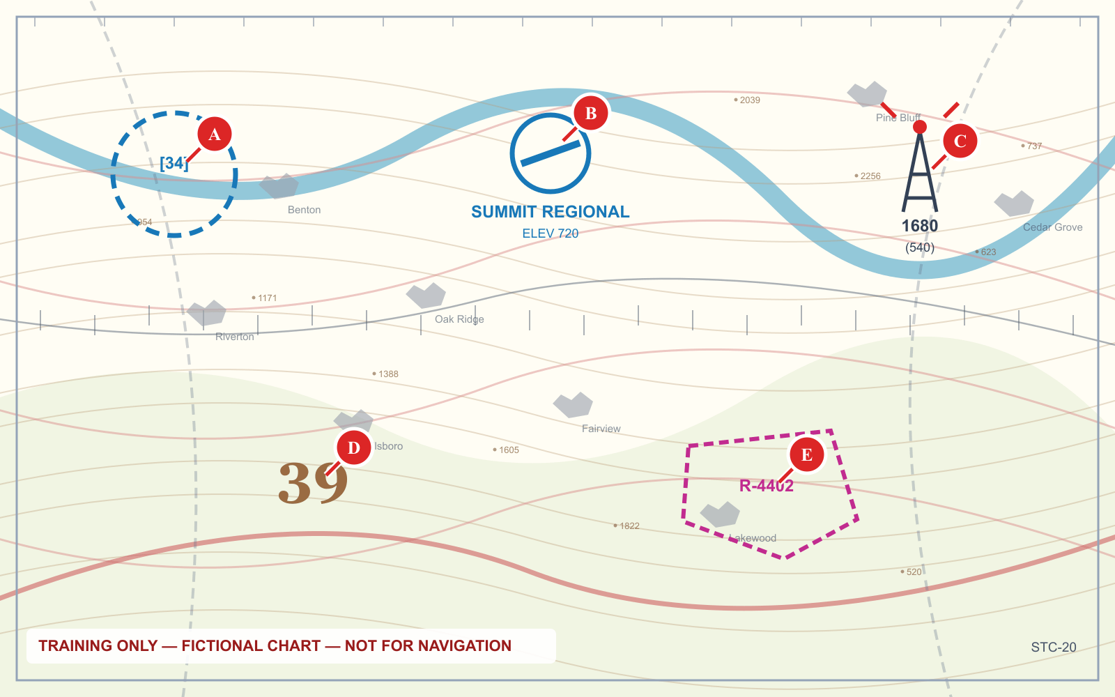
Once you separate those two layers, the chart stops being cluttered. Below are the symbols that actually carry Part 107 questions, in the order you would use them.
1. Boundary colors: blue is busy, magenta is quieter
Five conventions classify almost any point on a chart:
| What you see | What it means |
|---|---|
| Solid blue | Class B |
| Solid magenta | Class C |
| Dashed blue | Class D |
| Dashed magenta | Class E surface area |
| Faded magenta vignette | Class E begins at 700 ft AGL; Class G below |
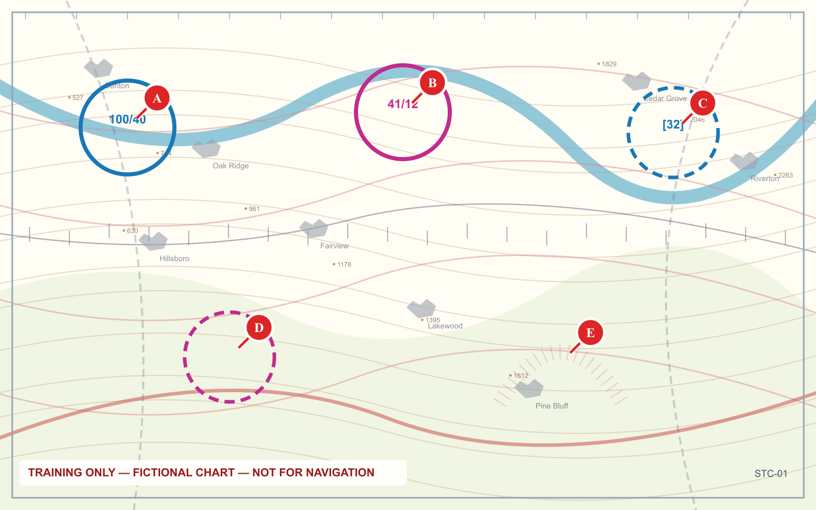
The useful mnemonic: blue means busy, magenta means quieter, and dashed means it comes all the way down.
2. Boxed numbers: ceiling over floor
Wherever airspace is stacked, the chart prints a pair of figures in a box. The upper figure is the ceiling, the lower is the floor, both in hundreds of feet MSL.
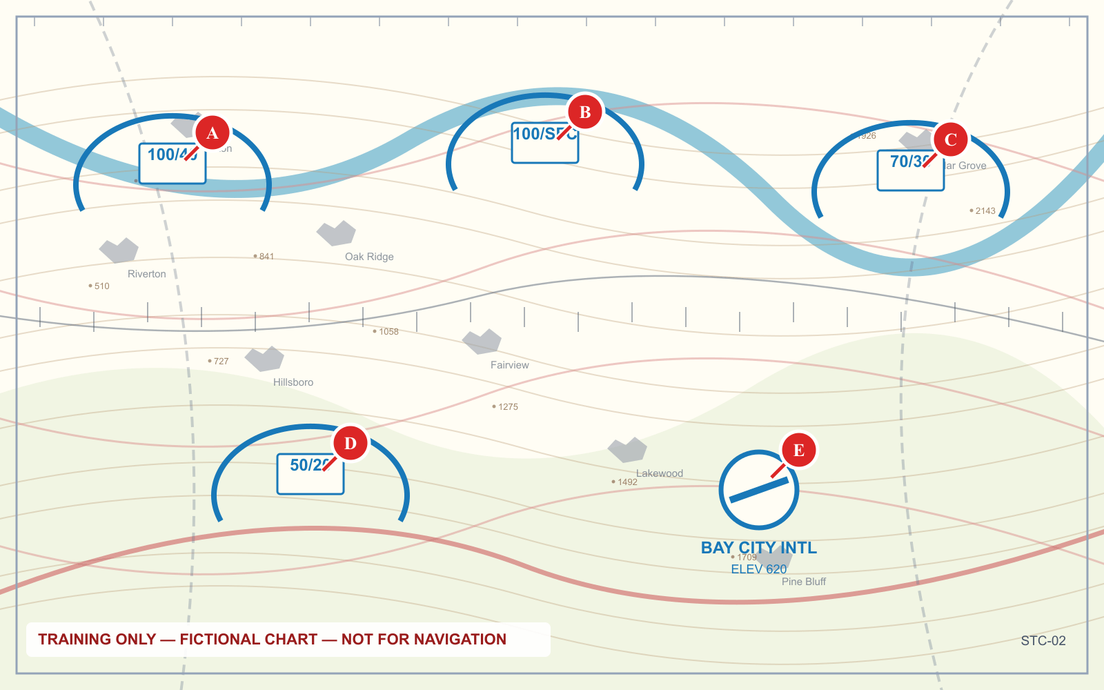
100/40— from 4,000 feet MSL up to 10,000 feet MSL100/SFC— from the surface to 10,000 feet MSL70/30— from 3,000 to 7,000 feet MSL
This is the single highest-value symbol on the chart for a drone pilot, because it is what tells you whether you are under an airspace shelf or inside it.
Class D uses a slightly different convention — a bracketed ceiling rather than a pair:
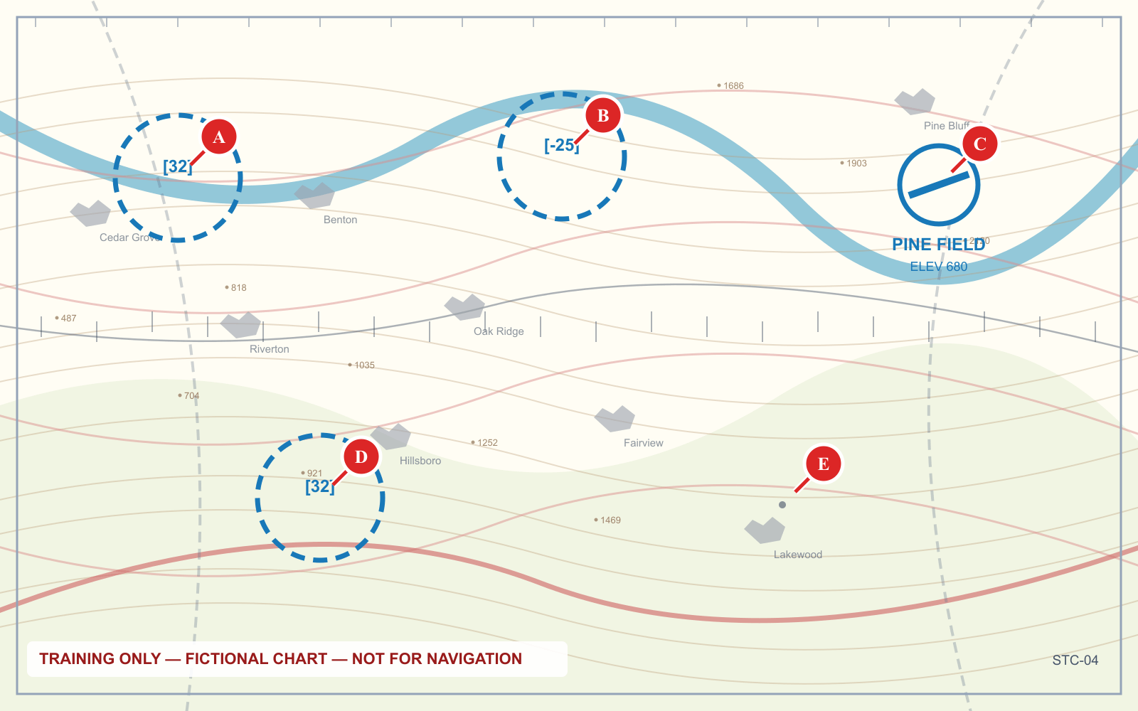
3. Airport symbols: shape and color both carry meaning
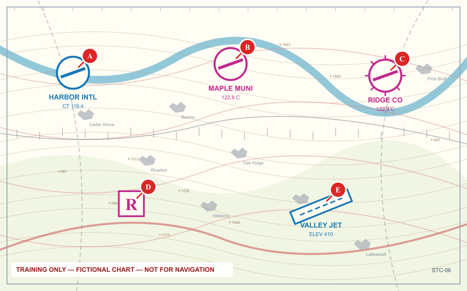
| Feature | Meaning |
|---|---|
| Blue symbol | Operating control tower |
| Magenta symbol | No operating control tower |
| Tick marks around the circle | Fuel available |
| Runway outline shown | Runway length 8,069 ft or longer, hard surface |
| Circle only | Shorter or soft-surface field |
| R in a box | Private field, not for public use |
Blue versus magenta is not the same question as whether you need authorization — the airspace boundary tells you that. But a blue symbol is a reliable warning that the field is busy.
4. Obstructions and their two numbers
Every charted obstruction carries two heights, and confusing them is one of the most reliable ways to get a question wrong.
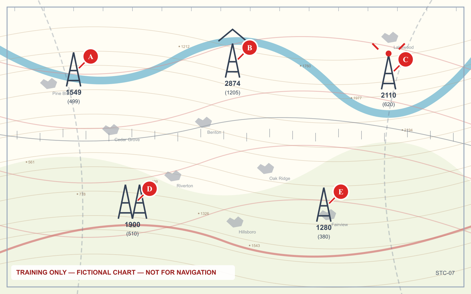
- Top figure — the top of the obstruction above mean sea level
- Bracketed figure — the height of the obstruction above the ground
A single tower is drawn as a narrow spike; a group is drawn joined. Obstructions with high-intensity lighting carry a flash symbol around the base.
Why this matters operationally: 14 CFR 107.51 lets you fly higher than 400 feet AGL when you are within a 400-foot radius of a structure, up to 400 feet above that structure's uppermost limit. The bracketed AGL figure is what that calculation uses.
5. Terrain tinting and maximum elevation figures
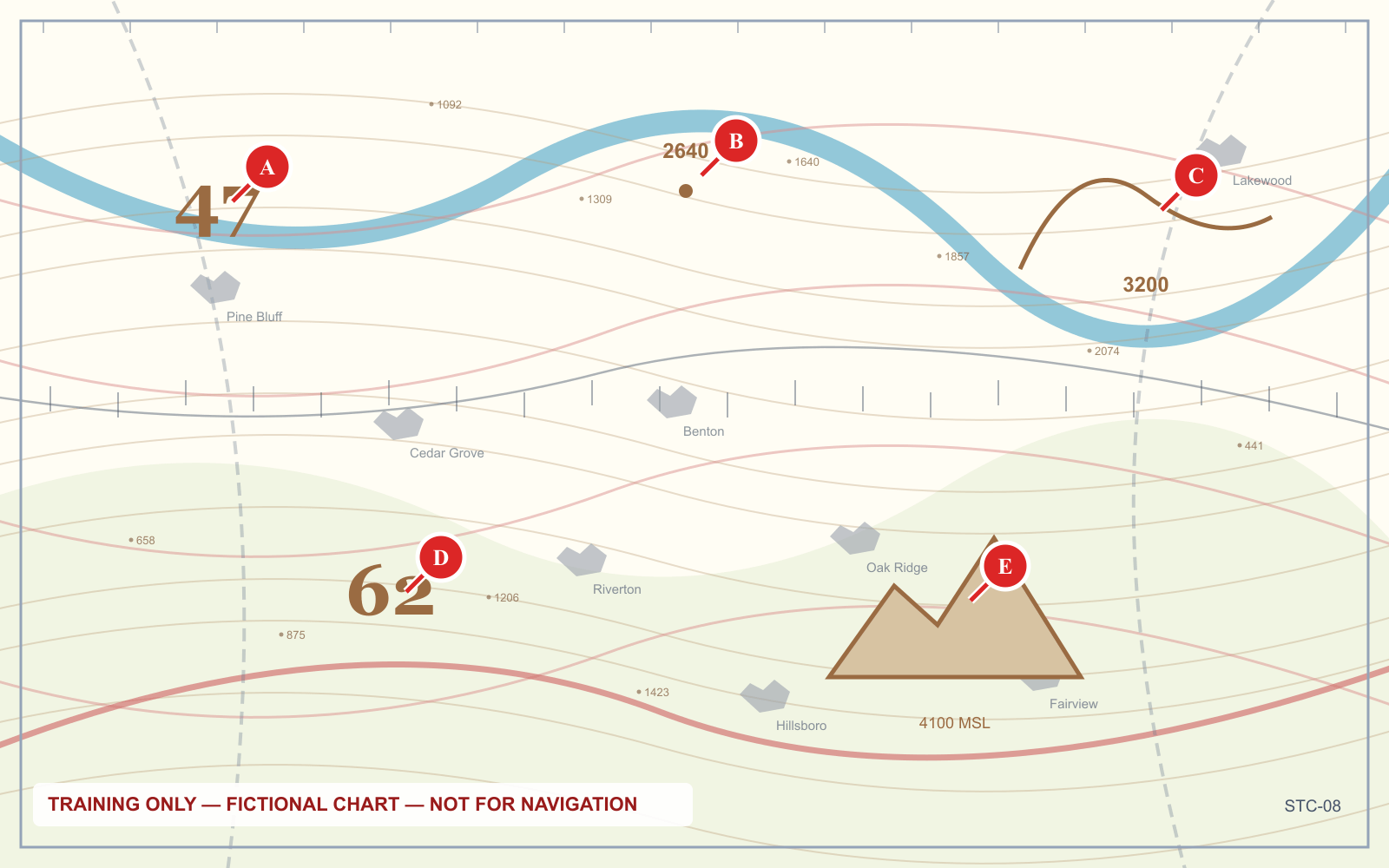
The large, widely spaced digits printed across each quadrangle are maximum elevation figures. Read them as thousands and hundreds of feet MSL — a large 2 beside a smaller 7 means 2,700 feet MSL.
An MEF accounts for the highest terrain or obstruction in that quadrangle, so it is a clearance figure, not a terrain elevation.
6. Frequencies and the white C
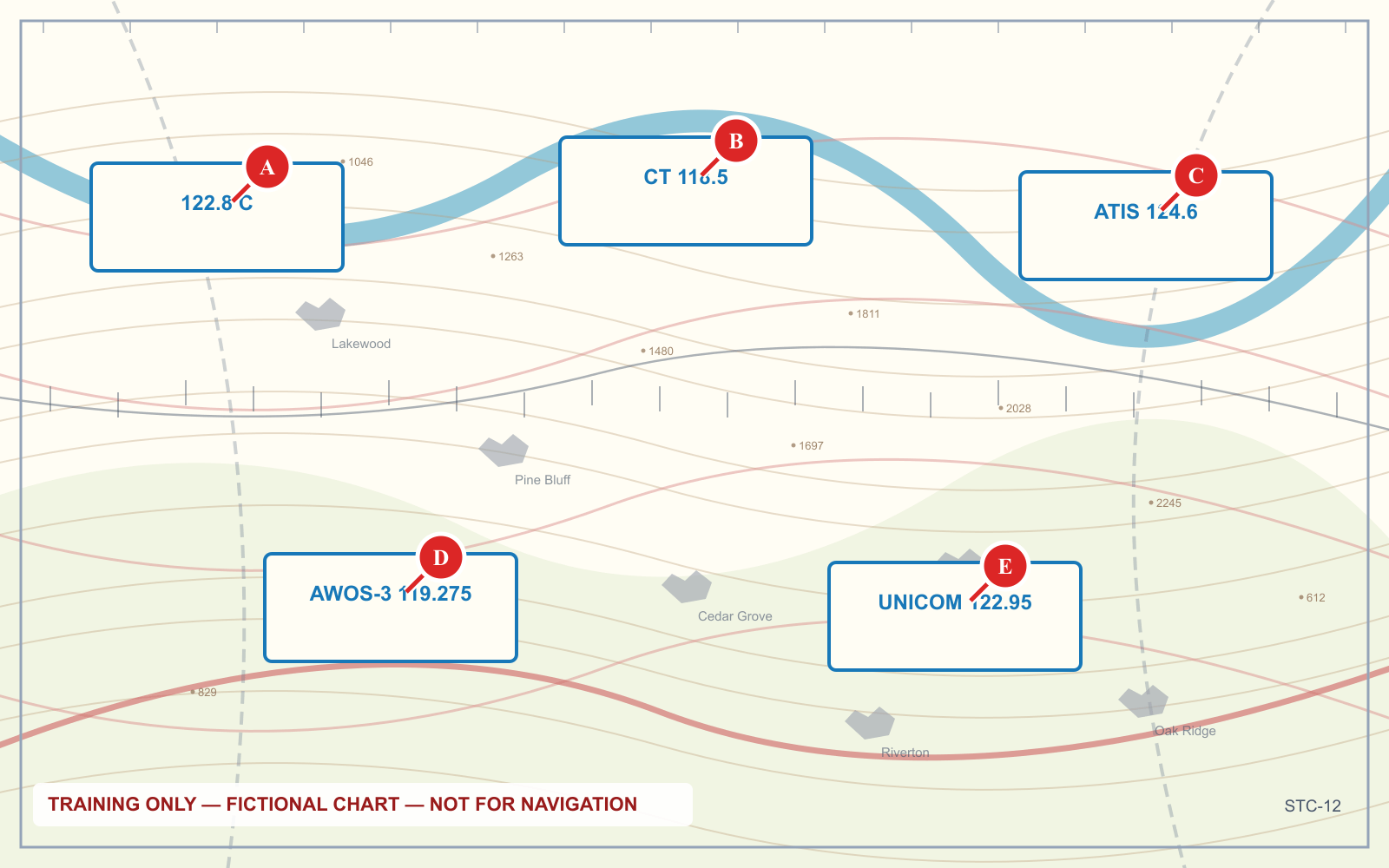
The airport data block is a compressed table:
- CT — control tower frequency
- White C in a solid circle — CTAF, the common traffic advisory frequency
- ATIS / AWOS / ASOS — recorded or automated weather
- UNICOM — advisory frequency, often the same as CTAF
- The number after the airport name is field elevation in feet MSL
- L means lighting; *L means lighting on request or part-time
- The last figure is the longest runway in hundreds of feet
For a remote pilot the CTAF is the one that matters. Monitoring it near a non-towered field tells you the active runway and who is inbound.
7. Special use airspace
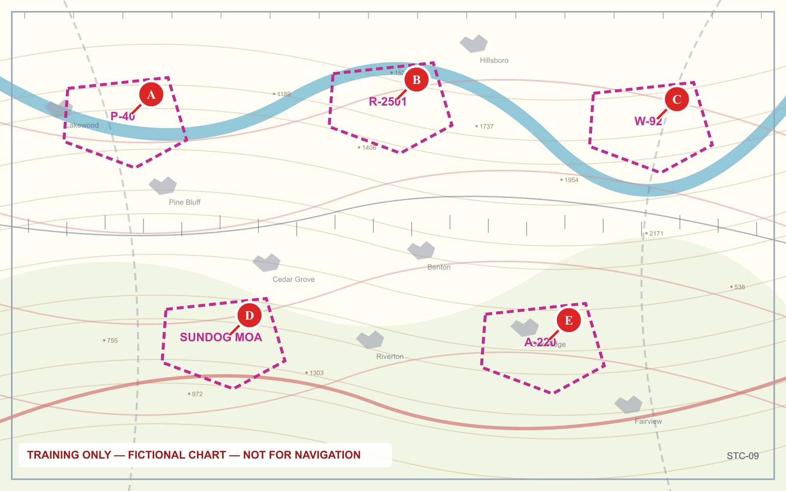
| Prefix | Type | Practical meaning |
|---|---|---|
| P | Prohibited | Flight is not permitted, period |
| R | Restricted | Permission required from the controlling agency |
| W | Warning | Over international water; hazards exist but no permission required |
| A | Alert | High-volume training; no permission required, extra vigilance expected |
| MOA (named) | Military Operations Area | No permission required; military aircraft maneuvering |
8. Military training routes: count the digits
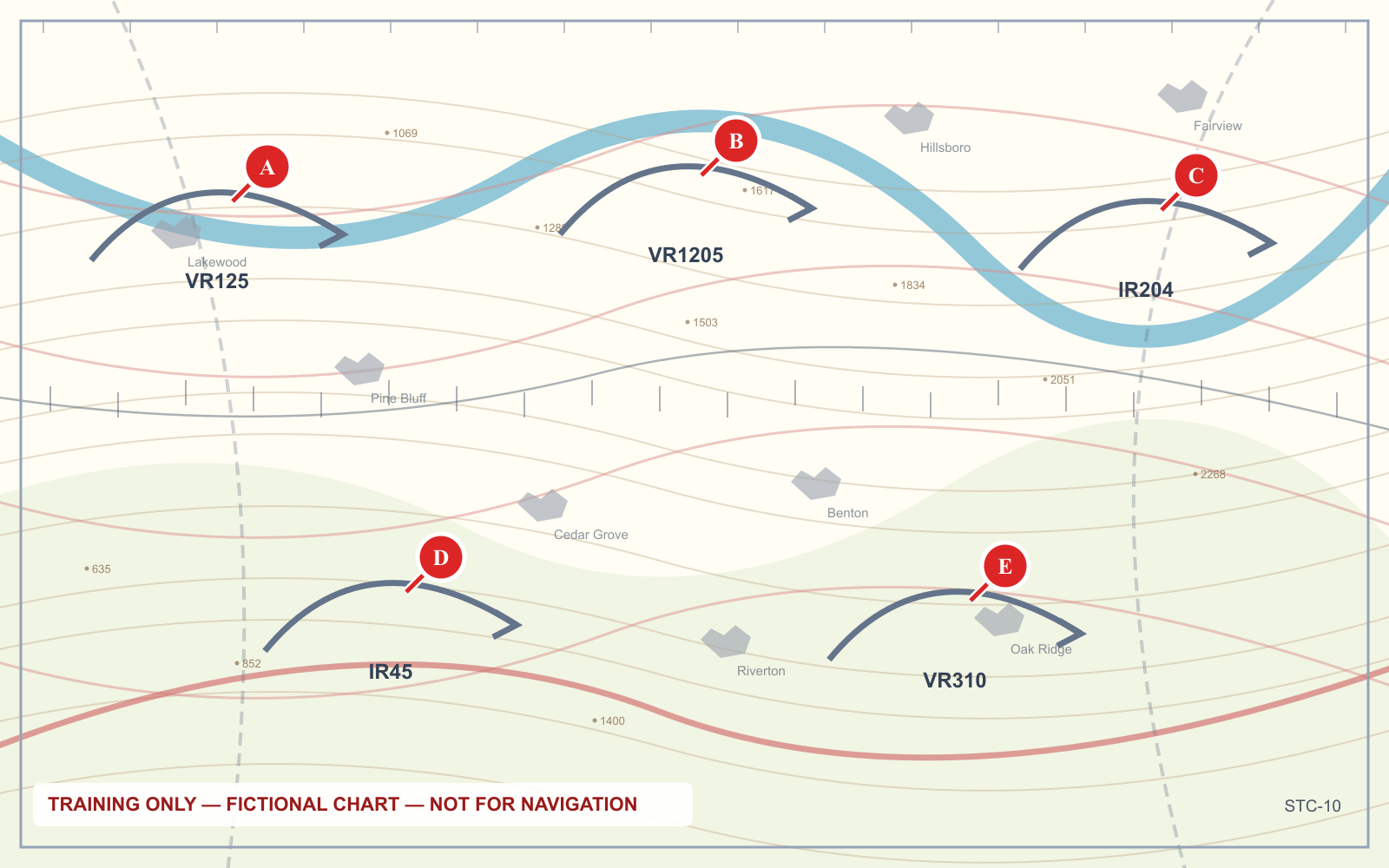
This one is worth memorizing precisely because it is easy to invert:
- Four digits (VR1207, IR1206) — the route has no segment above 1,500 feet AGL
- Three digits or fewer (VR52, IR204) — the route includes segments above 1,500 feet AGL
The four-digit routes are the low-level ones, and they are the ones that threaten a drone. Aircraft on them may be traveling above 250 knots at a few hundred feet.
IR is an IFR route flown in any weather; VR is a VFR route flown in visual conditions.
9. Latitude, longitude, and the line that is not a boundary
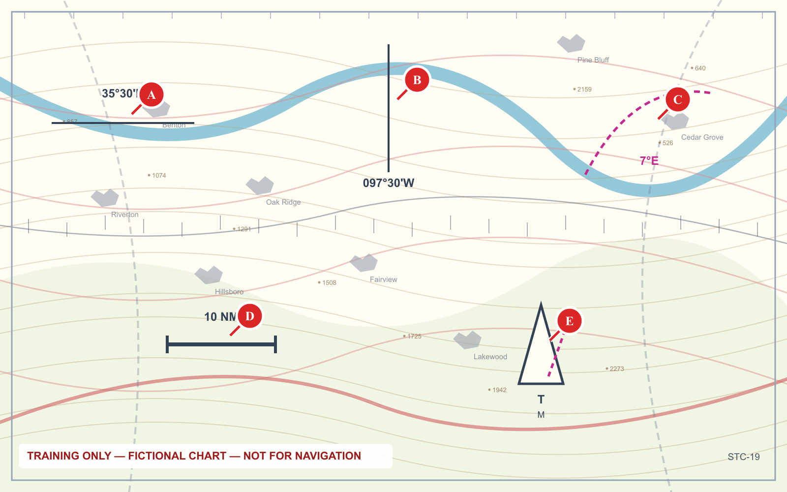
Latitude and longitude ticks run along the chart edges and across it, marked in degrees and minutes. One minute of latitude equals one nautical mile, which makes the latitude scale a usable ruler.
The dashed line labelled with a degree figure and an E or W is an isogonic line, marking magnetic variation. It is not a boundary of anything. It matters because runway numbers and tower-reported winds are magnetic while METAR winds are true, and the isogonic line is the conversion between them.
10. Class E surface areas versus the 700-foot floor
The distinction between the two magenta conventions is worth isolating, because it decides whether you need authorization:
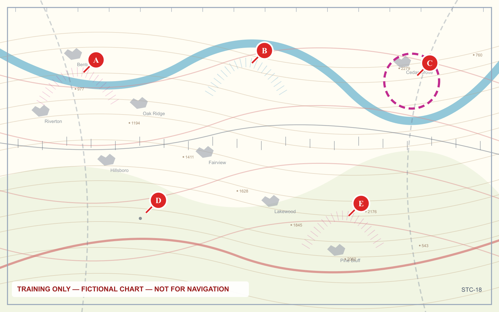
- Dashed magenta line — Class E from the surface. A Part 107 operation here needs authorization.
- Faded magenta band — Class E from 700 feet AGL. Below that you are in Class G and need none.
Both are magenta and both surround airports. The line style is the entire difference.
The procedure that answers any chart question
Symbols are only useful inside a routine. Every chart question yields to the same five steps:
- Find the exact point. Not the nearby airport, the point the question names.
- Read the boundary around it: solid or dashed, blue or magenta, or a faded vignette.
- Read any boxed figures as ceiling over floor, hundreds of feet MSL, and decide whether you are inside or beneath.
- For obstructions, take the top figure as MSL and the bracketed as AGL.
- Answer what was asked — usually what you must do, not what the chart says.
From 27 October 2026 the exam embeds chart images from current charts rather than a fixed supplement, which means memorizing particular figures stops working entirely. The procedure is the only thing that transfers.
Frequently asked questions
How do you read a sectional chart?
Work through it in layers. Identify the airspace boundary around your point by its color and line style, read any boxed altitude figures as ceiling over floor in hundreds of feet MSL, then read obstruction and terrain figures. Answer the question the chart is being used to answer rather than trying to absorb the whole panel.
What do the colors on a sectional chart mean?
For airspace, solid blue is Class B, solid magenta Class C, dashed blue Class D, dashed magenta a Class E surface area, and a faded magenta vignette Class E beginning at 700 feet AGL. Blue airport symbols have an operating control tower; magenta ones do not.
What do the two numbers next to an obstruction mean?
The upper figure is the height of the obstruction above mean sea level. The bracketed figure below it is the height of the obstruction above the ground at its base.
What does 100/SFC mean on a sectional chart?
It describes an airspace shelf running from the surface up to 10,000 feet MSL. Boxed figures are read as ceiling over floor in hundreds of feet MSL, and SFC means the airspace reaches the ground.
What is the white C in a circle on a sectional chart?
It marks the CTAF, the common traffic advisory frequency, used for self-announced position reports at airports without an operating control tower.
How do you identify a military training route on a sectional?
Military training routes are labelled IR or VR followed by a number. Four digits means no segment of the route lies above 1,500 feet AGL; three digits or fewer means the route includes segments above 1,500 feet AGL.
Reading about symbols and identifying them under time pressure are different skills. The sectional chart trainer puts lettered points on real chart panels and asks the questions the exam asks.
Sources
Put this guide into practice.
Take the free assessment to see how this topic fits into your current exam readiness.
Start free practice