Weather
How to Read a Crosswind Component Chart: Headwind, Crosswind, and the Wind Angle
A crosswind component chart splits one reported wind into the part that helps and the part that pushes you sideways. Here is how to read it, and how to do it without the chart.
Key takeaway
Crosswind equals wind speed times the sine of the angle between the wind and your heading. At 30 degrees you lose half the wind to crosswind; at 60 degrees you lose almost all of it.
A crosswind component chart splits a single reported wind into two numbers: the headwind component along your heading, and the crosswind component across it. You find the angle between the wind and your runway or track, follow that radial out to the arc for the wind speed, then read the crosswind down to the horizontal scale and the headwind across to the vertical one.
The chart looks like a piece of manned-aircraft trivia, and most of the pages that rank for it are calculators built for a Cessna. The arithmetic underneath is not aircraft-specific at all. It answers a question every remote pilot has on a windy job: of the 22 knots the automated station is reporting, how much of that is actually going to push my aircraft off the line I want it to fly?
What is a crosswind component chart?
It is a quarter-circle graph. The vertical axis is the headwind component, the horizontal axis is the crosswind component, the curved arcs are wind speeds, and the straight radial lines fanning out from the corner are wind angles, marked from 0 degrees along the vertical to 90 degrees along the horizontal.
Using it takes three steps:
- Find the angle between the reported wind direction and the heading you care about.
- Follow that radial line out until it crosses the arc for the reported wind speed.
- Read straight down for the crosswind component, and straight across for the headwind component.
That intersection point is the whole answer. The chart is just a way of doing trigonometry with a pencil, which is why it appears in FAA training material alongside the takeoff and landing performance charts in the Pilot's Handbook of Aeronautical Knowledge.
How do you calculate the crosswind component without a chart?
With two lines of trigonometry. Let V be the wind speed and θ the angle between the wind and your heading:
Crosswind = V × sin θ Headwind = V × cos θ
Worked example. The runway in use is 36, so the reference heading is 360 degrees. The tower reports the wind as 040 at 25 knots. The angle is 40 degrees.
- Crosswind = 25 × sin 40° = 25 × 0.64 = 16 knots
- Headwind = 25 × cos 40° = 25 × 0.77 = 19 knots
Notice that the two components do not add up to 25. They are the sides of a right triangle, not slices of a pie, so 16 and 19 combine to the 25-knot wind through Pythagoras rather than addition. This is the single most common mistake people make when they first meet the chart.
The table that replaces the chart
You do not need to find a crosswind component chart PDF on your phone in a field. This is the same information as a lookup table, and it is short enough to memorize the rows that matter.
| Wind angle | Crosswind factor | Headwind factor |
|---|---|---|
| 0° | 0.00 | 1.00 |
| 10° | 0.17 | 0.98 |
| 15° | 0.26 | 0.97 |
| 20° | 0.34 | 0.94 |
| 30° | 0.50 | 0.87 |
| 40° | 0.64 | 0.77 |
| 45° | 0.71 | 0.71 |
| 60° | 0.87 | 0.50 |
| 70° | 0.94 | 0.34 |
| 90° | 1.00 | 0.00 |
Multiply the wind speed by the factor in the column you want. Two rows carry most of the practical weight. At 30 degrees, half the wind is crosswind. At 45 degrees, the wind splits evenly, about 70 percent each way, which surprises people who expect 50-50. And past 60 degrees, the headwind benefit has essentially vanished while the crosswind is still growing.
The crosswind rule of thumb pilots actually use
The clock method. Treat the wind angle as minutes on a clock face and read the fraction of the hour:
- 15 degrees is a quarter past, so a quarter of the wind
- 30 degrees is half past, so half the wind
- 45 degrees is three quarters
- 60 degrees or more, take the whole thing
Against the table above, the clock method is accurate at 15 and 30 degrees, and it overestimates past 45 degrees. That is the right direction for an error to run. It tells you the crosswind is worse than it is, never better, so a decision made on the clock method is a conservative one.
The trap: which north is the wind referenced to?
This is where a correct calculation still produces a wrong answer, and it is worth more attention than the chart itself.
| Wind source | Referenced to |
|---|---|
| METAR or TAF, and the coded ASOS or AWOS output | True north |
| Tower, ATIS or the spoken automated broadcast | Magnetic north |
| Runway number | Magnetic north |
A METAR gives wind direction in degrees true, as the FAA's METAR key sets out. The spoken broadcast a pilot hears from the same field is given in degrees magnetic, precisely so it lines up with the runway numbers, which are themselves magnetic headings rounded to the nearest ten degrees.
So if you take the wind straight out of a METAR and subtract a runway heading, you are comparing true against magnetic, and your angle is wrong by the local magnetic variation. In parts of the country that is only a couple of degrees and does not change the answer. In Maine or Washington State it is well into double figures, which moves a 30-degree angle to a 45-degree one and changes the crosswind by a third.
What this means when you are actually working
A drone has no runway, no demonstrated crosswind component in a handbook, and no requirement anywhere in Part 107 that limits it by wind. What it has instead is a battery and a track it needs to fly. The chart still earns its place for three reasons.
Endurance. A multirotor holds position by tilting into the wind and adding power. The component that matters for a hover is the total wind, but on a linear mission, a survey grid or a linear inspection, the crosswind component is the part the aircraft spends power fighting on every single pass, in both directions. The headwind component is only expensive one way and gives some of it back on the return leg.
Track keeping. To hold a straight line across a crosswind the aircraft crabs into it. On a mapping flight that changes the ground footprint of each image and can open gaps between passes. The crosswind component, not the raw wind speed, is what sets the crab angle.
Groundspeed. 14 CFR 107.51 caps groundspeed at 87 knots, and while a typical camera drone is not going to reach it, the downwind leg of any pattern is where a groundspeed limit gets tested. The headwind component is the half of the calculation that tells you how much the wind is adding on the way back.
And there is the part you can be held to. 14 CFR 107.49 requires the remote pilot in command to assess the operating environment before flight, including local weather conditions. "It was windier than I expected" is not an assessment. Splitting a reported wind into the component along your track and the component across it is.
One more thing the surface report will not tell you: wind generally increases with height above the ground as surface friction falls away. The 12 knots you measure at head height at the launch point is not the wind your aircraft meets at 300 feet, and the direction usually shifts as well. Treat the surface reading as the floor of what you are going to get.
How the exam asks about this
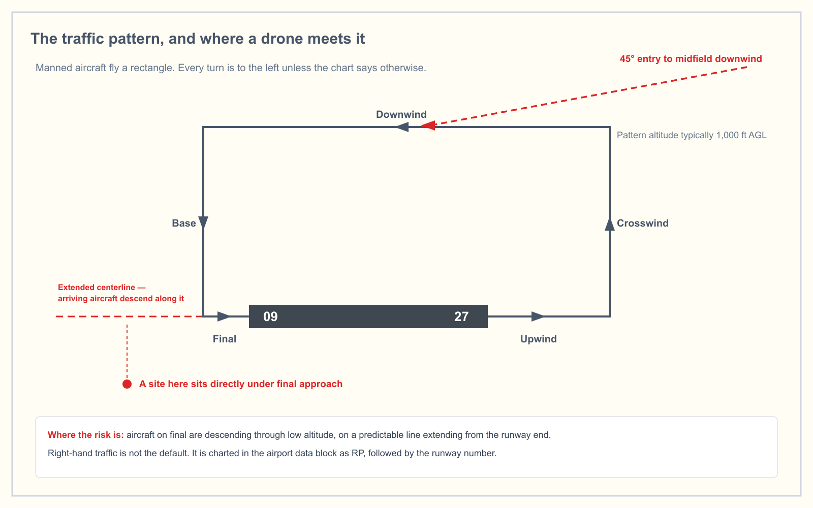
Gently, and rarely. Loading and Performance is 2 percent of the Unmanned Aircraft General knowledge test under the blueprint effective 29 September 2025, which is one or two questions out of 60. Where wind shows up more often is in the Weather area and in chart-reading questions, usually as a runway-in-use question: given a wind, which runway would traffic be using? The answer is the runway whose number is closest to the wind direction, because that gives the greatest headwind component and the smallest crosswind component.
That is the crosswind chart in reverse, and it is worth practicing on real chart panels rather than in the abstract. The sectional chart trainer puts runway alignments and airport data in front of you the way the test does.
Frequently asked questions
How do you use a crosswind component chart?
Find the angle between the reported wind direction and your runway or track heading, follow that angle's radial line out from the corner of the chart until it meets the curved arc for the reported wind speed, then read straight down to the horizontal scale for the crosswind component and straight across to the vertical scale for the headwind component.
What is the crosswind component rule of thumb?
The clock method. Read the wind angle as minutes on a clock: 15 degrees is a quarter of the wind, 30 degrees is half, 45 degrees is three quarters, and 60 degrees or more is effectively all of it. It is accurate up to about 30 degrees and slightly overestimates beyond that, which errs on the safe side.
What is the formula for crosswind component?
Crosswind component equals wind speed multiplied by the sine of the angle between the wind and your heading. Headwind component equals wind speed multiplied by the cosine of the same angle. The two components form a right triangle with the total wind, so they do not add up to the reported wind speed.
Does a drone have a maximum crosswind component?
Not as a regulation. Part 107 sets no wind limit, and unlike a certificated airplane a small drone has no demonstrated crosswind component published by a certification process. Any wind figure in a drone's manual is a manufacturer's limit, and 14 CFR 107.49 still makes the remote pilot responsible for assessing local weather conditions before flight.
Is METAR wind true or magnetic?
METAR and TAF wind directions are referenced to true north. Wind given to you verbally by a tower or on an ATIS broadcast is referenced to magnetic north, so that it lines up with runway numbers, which are magnetic. Mixing the two introduces an error equal to the local magnetic variation.
Which runway is in use in a given wind?
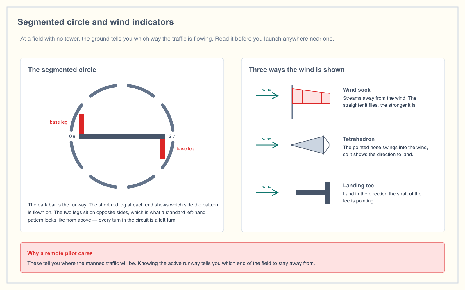
The one whose magnetic heading is closest to the wind direction, since aircraft take off and land into the wind. A wind from 210 degrees favors runway 21 over runway 18 or 24. On the ground you can confirm it from the wind sock or tetrahedron inside the segmented circle.
Want to know whether the weather and airport questions are actually sticking? The free readiness assessment mixes them in with the other four knowledge areas and shows you where you really stand.
Sources
Put this guide into practice.
Take the free assessment to see how this topic fits into your current exam readiness.
Start free practice