Weather
Adiabatic Lapse Rate: Dry, Moist and Standard, and How to Find the Cloud Base
Two numbers, 2 °C and 3 °C per 1,000 feet, and almost every explanation confuses them. Sorting them out also gives you the cloud base before you launch.
Key takeaway
The 2 °C standard rate describes the air sitting still around you. The 3 °C dry adiabatic rate describes a parcel moving through it. Comparing the two is what tells you whether the air is stable.
An adiabatic lapse rate is the rate at which a parcel of air changes temperature as it rises or sinks, purely because the pressure around it changes. A rising unsaturated parcel cools at the dry adiabatic lapse rate of 3 °C (5.4 °F) per 1,000 feet. Once it saturates, it cools more slowly, at the moist adiabatic lapse rate of 1.1 °C to 2.8 °C per 1,000 feet.
Search this topic and the top result is a pilot asking whether the number is 2 °C or 3 °C. That confusion is the whole subject in one question, and nobody ever answers it properly. Both numbers are correct. They describe two different things that happen to share a unit, and until you separate them, nothing else about atmospheric stability will make sense.
Why the answer is both 2 °C and 3 °C
Two separate measurements are hiding behind the phrase "lapse rate."
2 °C per 1,000 feet is the standard atmosphere. It is a modeled description of the air that is already there, sitting still, stacked from the surface upward. The Glider Flying Handbook states it as 2 °C (3.5 °F) per 1,000 feet below 36,000 feet. It is an average, and the handbook is blunt that the standard lapse rate seldom actually exists on any given day.
3 °C per 1,000 feet is the dry adiabatic lapse rate. It is not a description of the atmosphere at all. It is what happens to one parcel of air when you lift it, and it is fixed by physics rather than by weather.
So one number describes the room. The other describes something moving through the room. Asking which is "the" lapse rate is like asking whether the correct speed is the speed limit or the speed of your car.
What "adiabatic" actually means
Adiabatic means no heat is exchanged with the surroundings. A parcel of air lifted to a higher altitude finds lower pressure there, so it expands. Expansion costs energy, the parcel spends its own internal energy doing it, and its temperature falls. Nothing warmed it or cooled it from outside. It cooled because it got bigger.
This is why the dry rate is a constant. It is not a weather observation that varies with the day; it is thermodynamics, and a lifted parcel of unsaturated air will cool at 5.4 °F per 1,000 feet whether the day is calm or violent.
It also runs in reverse. A parcel forced downhill compresses and warms at the same 3 °C per 1,000 feet, which is why air descending the lee side of a ridge arrives hot and dry.
The four lapse rates, side by side
| Lapse rate | Value | What it describes |
|---|---|---|
| Standard | 2 °C (3.5 °F) per 1,000 ft | The modeled average atmosphere, below 36,000 ft |
| Ambient (environmental, actual) | Varies hour to hour | The real temperature profile of the air around you today |
| Dry adiabatic (DALR) | 3 °C (5.4 °F) per 1,000 ft | An unsaturated parcel being lifted |
| Moist adiabatic (SALR) | 1.1 °C to 2.8 °C (2 °F to 5 °F) per 1,000 ft | A saturated parcel being lifted |
The ambient rate is the one that carries all the information about today. The other three are fixed reference values you compare it against.
Why the moist adiabatic rate is shallower
When a rising parcel cools to its dew point, the water vapor in it starts condensing. Condensation releases latent heat, the heat that was absorbed when that water evaporated in the first place. That heat is dumped straight back into the parcel.
So the parcel is still cooling by expansion, but it is now being warmed from inside at the same time. The net cooling slows to somewhere between 1.1 °C and 2.8 °C per 1,000 feet, as the Balloon Flying Handbook gives it. Unlike the dry rate, it is genuinely a range, because how much latent heat is available depends on how much moisture the parcel is carrying.
This single fact is the engine behind every thunderstorm. A saturated parcel cooling slowly stays warmer than the air around it for longer, so it keeps rising, so more vapor condenses, so more heat is released. That is why moist warm air is so much less stable than dry air at the same temperature.
How the lapse rates decide stability
Compare the ambient lapse rate to the two adiabatic rates and you get three outcomes. These are FAA definitions, not rules of thumb.
| Condition | When it happens | What it means |
|---|---|---|
| Absolute stability | Ambient rate is less than the moist adiabatic rate | Stable regardless of moisture content. A lifted parcel becomes colder than its surroundings and sinks back |
| Conditional instability | Ambient rate lies between the moist and dry rates | Stable until something lifts the parcel far enough to saturate it, then it runs away |
| Absolute instability | Ambient rate is greater than the dry adiabatic rate | Unstable regardless of moisture. A parcel lifted even slightly keeps going on its own |
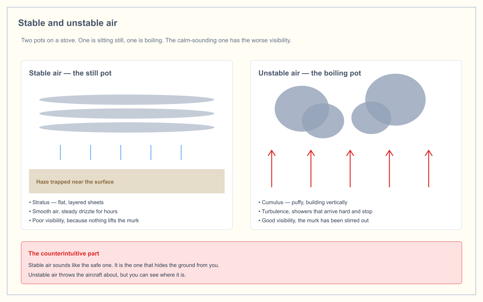
Conditional instability is the one worth understanding, because it describes the day that looks fine at 9 a.m. and produces thunderstorms by 3 p.m. The air is not unstable yet. It only needs a trigger, and daytime heating, terrain or a front will supply one. There is more on what each of those columns looks like from the ground in the article on stable versus unstable air.
How to find the temperature at altitude
This one uses the standard rate, not the adiabatic rate, because you are asking about the air that is already sitting up there rather than about a parcel you lifted.
Subtract 2 °C for every 1,000 feet of altitude gain. Surface temperature 20 °C, and you want the temperature at 3,000 feet: 20 − (3 × 2) = 14 °C.
The same calculation drives density altitude, which is where the standard atmosphere actually bites a multirotor.
How to calculate the cloud base
Here is the practical payoff, and it is the reason to learn the dry rate as a number rather than a concept.
A lifted parcel cools at 5.4 °F per 1,000 feet. Its dew point falls too, but far more slowly, at about 1 °F per 1,000 feet. So the gap between them closes at 4.4 °F per 1,000 feet. That is the convergence rate. When the gap reaches zero, the parcel is saturated, and that altitude is the cloud base.
The Balloon Flying Handbook gives the arithmetic directly:
(Temperature − dew point) ÷ 4.4, then × 1,000 = cloud base in feet AGL
Its worked example: a surface temperature of 85 °F and a dew point of 71 °F is a spread of 14 °F. Divide by 4.4 and you get 3.18. Multiply by 1,000 and the cloud base sits at roughly 3,180 feet AGL.
You already have both inputs. They are the last group before the altimeter setting in every METAR, reported in whole degrees Celsius. To use the 4.4 figure, convert to Fahrenheit first, or divide the Celsius spread by 2.5 instead and use the same steps.
What this means when you are actually working
Run that formula backward and it turns into a go/no-go check you can do from the truck.
Under 14 CFR 107.51 you must stay 500 feet below any cloud. To fly at the full 400 feet AGL and keep that clearance, the cloud base has to be at 900 feet AGL or higher. Work out what spread that requires: 900 ÷ 1,000 × 4.4 gives you about 4 °F, which is roughly 2 °C.
So the rule of thumb is this. If the temperature and dew point in the METAR are within about 2 °C of each other, the estimated cloud base is too low for a 400-foot flight. At a 1 °C spread the estimate is around 400 feet AGL, which means the cloud is sitting where you wanted to put the aircraft.
That same narrow spread is the fog signal, which is not a coincidence, since fog is a cloud whose base reached the ground. The types of fog article covers what forms at that point.
Treat the number as an estimate. It assumes a well-mixed parcel lifted from the surface, so it predicts convective cumulus bases well and tells you very little about a stratus layer that arrived from somewhere else. Use it to decide whether to drive out, then use the reported ceiling when you get there.
How the exam asks about lapse rate
Weather is 5% of the current UAG blueprint, effective 29 September 2025, so expect a handful of questions rather than a section. Lapse rate itself is rarely asked as a definition. It shows up as the reasoning behind other questions:
- Stability from a temperature profile. Given an ambient rate, compare it to 3 °C per 1,000 feet. Steeper means unstable, which means cumuliform cloud and turbulence.
- What a small temperature and dew point spread indicates. The answer is a low cloud base, and fog or low stratus if the spread closes at the surface.
- Predicting cloud type. Unstable air builds vertically into cumulus; stable air spreads horizontally into stratus. The cloud types follow directly from which lapse rate wins.
Frequently asked questions
What is the dry adiabatic lapse rate per 1,000 feet?
3 °C, or 5.4 °F, per 1,000 feet. It applies to a parcel of unsaturated air being lifted, and it is a physical constant rather than a weather observation. The same rate warms a parcel that is forced to descend, because the parcel is compressed by the rising pressure around it.
What is the difference between the normal lapse rate and the adiabatic lapse rate?
The normal, or standard, lapse rate of 2 °C per 1,000 feet describes the static atmosphere around you and is an average that is rarely exactly true. An adiabatic lapse rate describes a specific parcel of air moving vertically through that atmosphere. One is the environment; the other is a process happening within it.
What is the moist adiabatic lapse rate?
Between 1.1 °C and 2.8 °C (2 °F to 5 °F) per 1,000 feet. It is shallower than the dry rate because condensation inside a saturated parcel releases latent heat, partly offsetting the cooling from expansion. It is a range rather than a constant because the amount of heat released depends on how much moisture is condensing.
How do you calculate the height of the cloud base?
Subtract the dew point from the temperature in Fahrenheit, divide by the convergence rate of 4.4, then multiply by 1,000 for the base in feet AGL. A temperature of 85 °F with a dew point of 71 °F gives a 14 °F spread, and a cloud base near 3,180 feet AGL.
Why does temperature and dew point converge at 4.4 °F per 1,000 feet?
A lifted unsaturated parcel cools at 5.4 °F per 1,000 feet while its dew point drops at only about 1 °F per 1,000 feet. The difference between those two rates, 4.4 °F per 1,000 feet, is how fast the spread closes. When it reaches zero the parcel is saturated and cloud forms.
Is a steeper lapse rate more dangerous for a drone?
A steep ambient lapse rate means unstable air, so expect thermals, gusty surface wind and building cumulus. For a multirotor that means constant attitude corrections and a battery draining faster than planned. A shallow rate means stable air, which is smoother but brings the low ceilings and poor visibility that end flights legally.
Lapse rate, stability and cloud formation are tested as one topic rather than separately. The free readiness assessment mixes weather questions in with the other four knowledge areas so you can see whether it is actually a weak spot.
Sources
Put this guide into practice.
Take the free assessment to see how this topic fits into your current exam readiness.
Start free practice